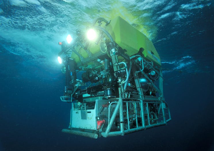
© ROV Victor 6000 - Ifremer - Dugornay Olivier
What is lidar and how does it work?
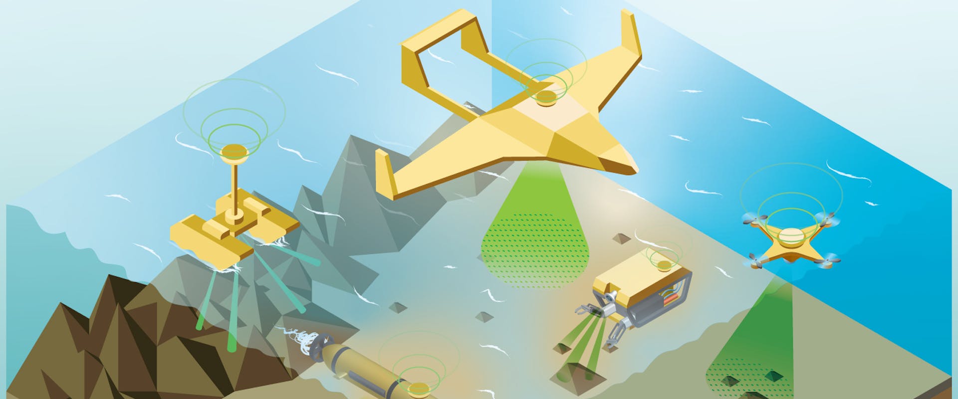
Lidar technology employs laser beams to measure distances with high precision. By emitting laser pulses toward a target and measuring the time it takes for the reflections to return, lidar systems can generate detailed three-dimensional models of the surveyed environment.
In the space domain, which initiated this development at the CSEM, lidar is used to map planetary surfaces, detect obstacles and help spacecraft land. Applied to the underwater domain, lidar can be used to explore and map the seafloor, such as seismic faults, hydrothermal sources, etc. Laser pulses can penetrate water up to tens or dozens of meters depending on the water turbidity, allowing for the collection of precise data on the underwater topography. This technology offers significant advantages over traditional methods, providing high-resolution images and allowing for faster and more detailed surveys.
Traditionally utilized in space applications for planetary surface mapping, obstacle detection, and spacecraft landing assistance, lidar technology is now being adapted for underwater use. In marine settings, lidar can be employed to explore and map the seafloor, including features such as seismic faults and hydrothermal vents. Depending on water turbidity, laser pulses can penetrate approximately 10 to 20 meters, enabling the collection of precise data on underwater topography. This approach offers significant advantages over conventional methods by providing high-resolution images and facilitating faster, more detailed surveys.
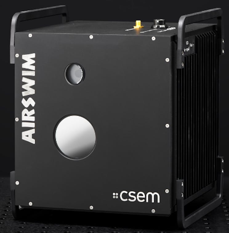
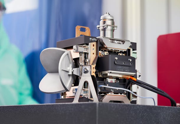
Casing of the current prototype developed by CSEM
A cutting-edge tool for studying the deep ocean
Since 2021, Ifremer has been coordinating the DeepSea'Nnovation project, which is funded by the French government (ANR-21-ESRE-0042). Scheduled to continue until 2029, the project seeks to revolutionize deep-sea exploration by developing advanced scientific equipment for the French Oceanographic Fleet's (FOF) underwater robots. The FOF will thus be equipped with state-of-the-art instruments offering new capabilities in data acquisition, observation, and sampling. Ultimately, the project will encompass a wide range of applications, from geophysical and geological studies to biological and physicochemical analyses.
Among the major innovations of DeepSea'Nnovation is the development of a lidar system tailored to the challenges of the underwater environment. This technology complements traditional seafloor mapping methods, which rely on acoustic sensors or optical cameras.
Optical systems require close-range surveys (less than 7–8 meters) due to light attenuation, while traditional acoustic surveys necessitate longer distances (several tens of meters). The resulting terrain models also differ in resolution, ranging from less than 1 centimeter for camera-based surveys to over 20 centimeters, or often more than 1 meter, for acoustic surveys conducted from underwater vehicles.
The lidar system will produce highly detailed terrain models with a resolution of a few centimeters and a range of up to 15 or even 20 meters. Thus, lidar will serve as a mapping tool offering an unprecedented compromise in terms of resolution and coverage speed compared to currently available solutions.
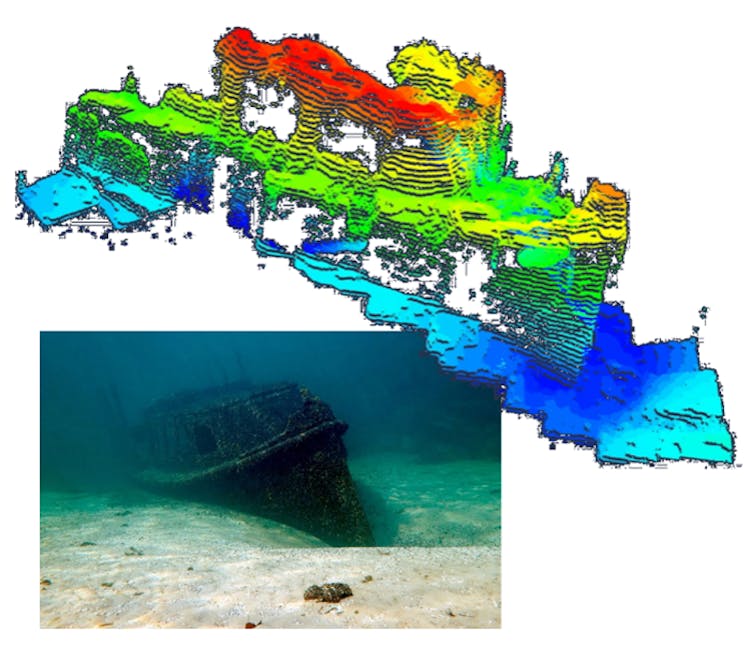
Wreck of Julie-La-Rousse II: lidar and photo
Two years of production and three years of maintenance
CSEM has until autumn 2026 to design and manufacture the scientific instrument for Ifremer. While it can leverage its experience with space-based lidar and Ifremer's expertise in underwater optics, its team will face specific challenges. Variations in water turbidity at different observation sites impose significant constraints on optical design and embedded electronics. Additionally, the instrument must achieve a high degree of autonomy to process the vast amounts of collected data while adhering to communication limitations (no continuous processing). Given that volume is inherently associated with higher costs in both space and underwater domains, specialists will aim to limit the lidar's size to predefined dimensions. Ifremer will ultimately apply its expertise to adapt the instrument for marine use within a watertight housing capable of reaching depths of 6,000 meters and to utilize the lidar data to produce high-resolution 3D maps.
Learn more
Would you like to know more? Please visit our dedicated scientific instruments page or contact us.